|
This is Page 1 of 4 - the best of March 2017!
posted: March 31st, 2017 |
Go To Page:


|
This page begins with a single photo taken on March 2nd, and then jumps to sunrise on March 3rd. Then we progress to midday of March 3rd, and a walk up our hand-shoveled driveway. After that there are two panoramic images taken on March 4th, which give you an idea of our snow depth. Then we jump to March 6th, and an outing we took down the George Parks Highway from Fairbanks to Nenana. Click on any thumbnail to begin.
|
 The first shot in this row shows a female Downy Woodpecker (Picoides pubescens) on our suet feeder. The second and third shots show the sun rising at 9:00 AM on March 3rd, from our porch.
|
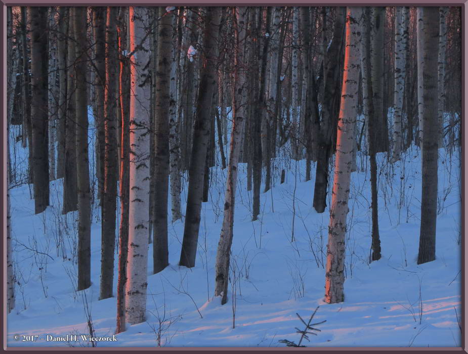
 The first shot in this row also shows sunrise colors at 9:00 AM on March 3rd. Later in the day I went out to take snow photos, so the second and third shots were taken at around 12:08 PM as I walked up the driveway. Every visitor who comes to our house expresses amazement that we have shoveled it all by hand all winter long, so I wanted to show you these photos. This is the tenth snowiest winter on record for Fairbanks, Alaska, with a total of 80.72 inches of snowfall to date. In October we had 0.82 inches, in November we had 4.4 inches, in December we had 33.5 inches, in January we only had 17.0 inches, in February we had 23.3 inches, and in March we had 1.7 inches. We have spent a lot of hours shoveling snow! Oh, by the way, there is supposedly 36 inches of snow on the ground. That's a lot less than the 80.72 inches of total snowfall, due primarily to settling. There has not yet been much melting.
|
 The first shot in this row shows the turn-around spot, the second shot shows the uphill portion of the driveway and in the third shot, I am getting close to the road.
|
 Now I am standing on the road. The first shot is looking down the driveway, the second shot is looking up the road and the third shot is looking down the road. The glare you see is the sun reflecting off the "hardpack" the snow that is solidly packed on the road and will not disappear until it gets warmer, sometime in April.
|
 Here is a two-shot panorama which looks at the house from the top of the driveway. The second shot was taken as I was walking back down the driveway.
|
 Here is a shot of the turn-around area from the opposite side of the previous one and then a shot taken the following day, which shows another moose ambling across our back property.
|
| End March 2nd and 3rd, Begin March 4th and 6th
|
 Here are two, three-shot panoramic images. The first image was taken from right beside the west side of the house and looks to the west. Note the amount of snow in the "swing". The second image was taken from the driveway, looking south. Note that the snow on the house roof has been shoveled once.
|
 Kazuya got an excellent deal on some Tulips at Fred Meyer West Fairbanks and this shows them a couple of days after purchase. On March 6th we took a drive down to Nenana, Alaska on the George Parks Highway and the second shot shows the West Ridge Area of the University of Alaska - Fairbanks campus. The third shot was taken from a highway overlook a short distance from Fairbanks and shows Denali, North America's tallest peak, at 20,310 feet (= 6,190 meters). This photo has been "Toned" to make the mountains stand out better, they were barely visible before the adjustments were made.
|
 The first two photos in this row are the same - the first one is unadjusted, just as it came from the camera, to show you how vague the mountains were. The second photo was adjusted to make the mountains show better. The third shot is a different photo, which was also adjusted to bring out the mountains.
|
 Here are three more distant mountain shots, which were taken from the same overlook on the George Parks Highway. The third shot is another adjusted one and it shows the Alaska Range near Delta Junction, Alaska.
|
 In first position is the final one from the overlook. It again shows the Alaska Range near Delta Junction. The second and third shots were taken not too much before we got to Nenana and show the Minto Flats Area.
|
 The first two shots here again show the Minto Flats Area. The third shot is the bridge over the Tanana River at Nenana, Alaska. On the next page we'll tell you why we wanted to drive to Nenana.
|
| End Page 1, but March 6th Continues on Page 2
|
|
Thanks so much for taking the time to look at this page. Now, please go on to Page 2 for the continuation of this month's adventures. Page 2 continues March 6th, from our arrival at Nenana, Alaska.
|
Go To Page:
|

(will open in new window)
|

Link to Amazon.com (new window).
We get 2% of whatever you spend if you go to Amazon from this link!! Please shop on Amazon from here.
|
If you would like to donate to our hiking & traveling fund or show your appreciation for our efforts you can donate through PayPal. A single donation will entitle you to request a single full-sized photo IN THE DONATION MONTH - which you may then use as a desktop wallpaper or whatever. The copyright will be retained by us and the photo will be inconspicuously marked with the copyright symbol (©), year and photographer's name. (Donation probably not tax deductible.)
|
|