|
This is Page 3 of 4 - the best of July 2009!
posted: July 31st, 2009 |
Go To Page:


|
The photos on this page continue with July 11th at 1:31 PM and go through the end of the day on July 17th. On this page we finish the climb of Mt. Yatsugatake and we start a climb of Mt. Kita-dake, the 2nd highest mountain in Japan (3,193 meters = 10,476 feet). It is located in Yamanashi Prefecture. Click on any thumbnail to begin.
|
| July 11th Continues From Page 2 (at 1:31 PM)
|
 In the first shot here you see one more example of Dicentra peregrina or Bleeding Heart. In the 2nd photo you can see those man-made rock gendarmes which I referred to on Page 1. These mark the trail from the summit of Mt. Io-dake down to the hut where we stayed last night. As I said on Page 1, when we came down that slope which you see ahead of us, we could not see from one gendarme to the next. That's what kind of a white-out it was, because as you can see, they are really quite close. The 3rd shot shows us ascending Mt Io-dake - for the 2nd time.
|
 When we crossed over Mt. Io-dake yesterday we had no idea this drop off was here - Kazuya knew that the location of the original volcanic eruption was from this mountain, but we did not know that it looked like this. Here are 3 shots of the original eruption site - the first shot looks to the north-northeast, the 2nd shot pretty much due east and the 3rd shot looks to the south-southeast.
|
 Here is me, and then Kazuya, at the summit of Mt. Io-dake (2,760 meters = 9,055 feet) - we could not find this signpost yesterday. The 3rd shot is another look into the eruption site.
|
 The first shot here is the east side (eruption side) of Mt. Io-dake, taken from Natsuzawa (summer creek) Pass. The 2nd shot is our goal for today - the Neishidake Hut. It has a bath!!! The 3rd shot is Mt. Neishidake (2,603 meters = 8,540 feet). We'll climb that one first thing tomorrow morning as we head "down" the mountain.
|
 Here are 2 shots as we continue our approach to the Neishidake Hut and then a 3rd shot as we get to the "front door". They get some ferocious winds here, which explains the rocks holding the roof down. WHEW! We hiked for about 9 hours today, we have no idea how many miles (or kilometers) we traveled, but it was quite a few.
|
| End July 11th, Begin July 12th
|
 It's now July 12th. It's 5:55 AM and breakfast will be served in about 5 minutes. We slept on the left side, on the bottom tier of beds. There were only 6 people staying here, so we did not have to fight over the beds! We are packed up and ready to go - we are trying for an 11:23 AM bus at a bus stop at least 4 hours away. The 2nd shot is the very best Bleeding Heart (Dicentra peregrina) which we saw - look at all of those flowers! The 3rd shot shows the last night's hut as we ascend Mt. Neishidake (2,603 meters = 8,540 feet). It's now 6:56 AM.
|
 Here is me at the summit of Mt. Neishidake. It's cold and a bit windy, which explains the rain jacket. It breaks the wind well. The 2nd shot is a Panorama of the 2 Tengudake Peaks (East Tengudake, which we climbed - on the right - and West Tengudake, on the left side of the photo). The 3rd shot is East Tengudake Mtn. (2,646 meters = 8,681 feet) as we start the descent of Mt. Neishidake and head for the East Tengudake Mountain.
|
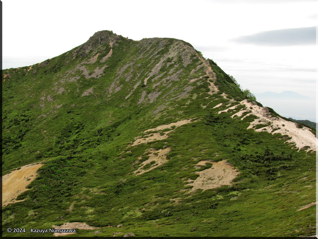
 The first shot here is West Tengudake Mountain. The 2nd shot is me at the summit of East Tengudake Mtn. The 3rd shot is looking way back to the south - Mt. Neishidake, Mt. Io-dake and all the way to Mt. Akadake, where we were yesterday for lunch.
|
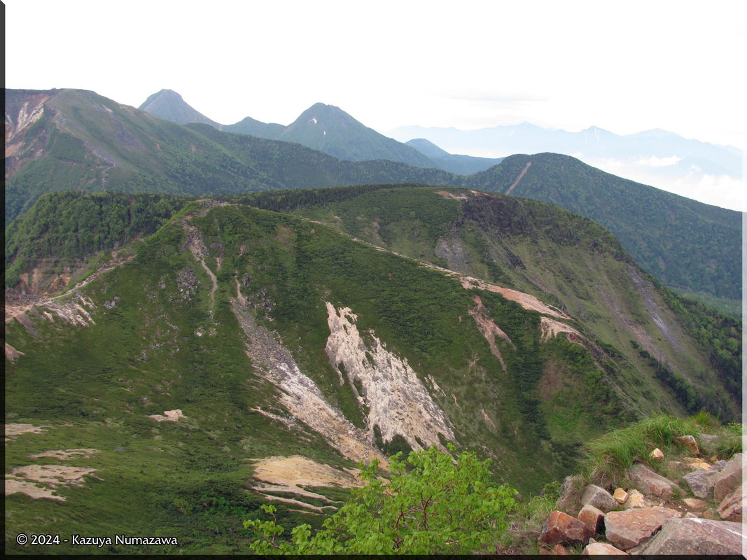
 Here is another shot looking back where we were yesterday - in this one maybe you can recognize the volcanic eruption point at Mt. Io-dake (far left). In the 2nd shot you can see one of those big ugly environment destroying groups of people, which came to East Tengudake just as we were leaving (actually they forced us to leave a couple of minutes earlier than we otherwise would have left) - noisy and rude - pushing for the summit sign to make sure they got their picture taken before the group moved on. BLAH! In the 3rd shot you can see the final hut we are going to pass. We will hike down on the left side of that tiny lake, keeping to the ridge top.
|
 In the first shot here we've passed that tiny lake and are looking back at East Tengudake. The 2nd shot is Kazuya as he gets closer to that hut, which we are just going to walk right on past. In the 3rd shot - a magnificent specimen of Monotropa sp. - we have passed the hut and are on the final stretch of the hike - only 15 minutes from the bus stop.
|
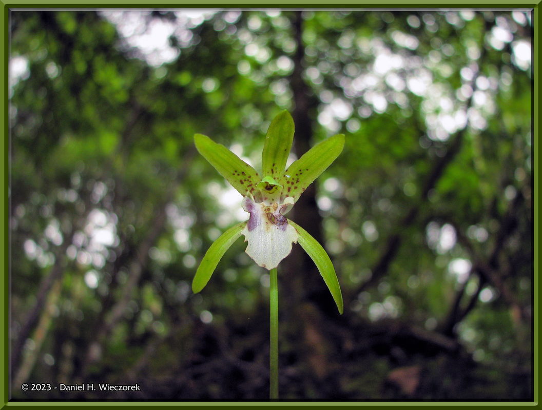
 Here is the final flower - a One-Leaved Orchid (Dactylostalix ringens). In the 2nd shot we are back at Chino Train Station - where we started out 2 days ago. Now we recognize the station sign as being a photo of Mt. Akadake, we didn't know that on Friday. And the final shot of the trip - Mt. Yatsugatake from the train! Amazing, eh!? Is this what is considered a massif?
|
| End July 12th, Begin July 17th
|
 On July 17th, 18th and 19th Kazuya and I climbed Mt. Kita-dake, the 2nd highest mountain in Japan (3,193 meters = 10,476 feet). It is located in Yamanashi Prefecture. The weather was mostly rainy for the entire 3 days of our adventure. The winds were terrible and we were mostly lost in the clouds, but we DID attain the summit and we made it back down in one piece. We never even actually got to see the mountain itself, we were always looking at clouds and rain in front of us. In the first photo here we are starting the climb. The ridge you see up there is not the summit at all. The 2nd photo shows a map and if you look at it full size CLICK HERE you can see that I have detailed it with "you are here", "first night's hut" and "2nd night's hut". I think you can find the summit. The 3rd photo is me - it was raining when we left home, it rained for the entire train ride and then rained for all but the last 15 minutes of the 2 hour bus ride to the starting point. Then it stopped raining for about 2 hours for this first part of the climb - you can see that I am not wearing rain gear at this time.
|
 Then it started raining! The first shot in this row is taken at the "first night's hut". You can see snow in the tiny little valley in front of the camera. In the 2nd photo you can see the snow better - right behind that person in the yellow wind breaker. The 3rd shot is the hut itself. It was a very nice place - looked practically brand new inside and out.
|
 Here is the sign at the hut - the Shirane-Oike Hut. As you can see, we are now at 2,230 meters. Here is the final picture for July 17th - the snow and a small pond at the hut.
|
| End July 17th, End Page 3
|
 This is a link to a separate web page showing some photos of our DVD Collection, an AVI Movie of our Home Theater System and 9 photos of our Sharp Aquos TV.
|
|
Kazuya has updated - his blog and it has some truly exquisite photos of our climbs! Please check it out HERE. (Click on the "Studies of Plants and Wildlife" link in the new window.)
|
|
Thanks so much for taking the time to look at this page. Now please continue on to the next page to see the conclusion of this climb of Mt. Kita-dake. You can use the e-mail link below to respond with any feedback you might have.
|
Go To Page:
|

Link to Amazon.com (new window).
We get 2% of whatever you spend if you go to Amazon from this link!! Please shop on Amazon from here.
|
If you would like to donate to our hiking & traveling fund or show your appreciation for our efforts you can donate through PayPal. A single donation will entitle you to request a single full-sized photo IN THE DONATION MONTH - which you may then use as a desktop wallpaper or whatever. The copyright will be retained by us and the photo will be inconspicuously marked with the copyright symbol (©), year and photographer's name. (Donation probably not tax deductible.)
|
|