|
This is Page 4 of 5 - the best of June and July 2016!
posted: July 31st, 2016 |
Go To Page:


|
This page begins with July 9th and an adventure Kazuya and I went on with Chris, Mary and Mark to Table Top Mountain, in the White Mountains National Recreation Area. After that, on July 13th Kazuya and I went out alone and climbed Wickersham Dome, also in the White Mountains National Recreation Area, but on a totally different highway and separated by many miles. Click on any thumbnail to begin.
|
|
|
 All of the photos in this row were taken at a rest stop along the Nome Creek Road (See Map above). The first photo shows scenery, Kazuya bent over searching for flowers and the outlined area is where we are going today and is shown prominently in the second photo - Table Top Mountain. The third shot also shows Table Top Mountain, but it is not zoomed-in as much.
|
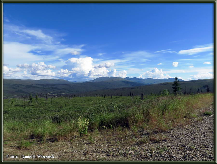
 These three photos all show additional scenery and were taken from the same rest stop as the ones in Row 1. I believe that you can tell that each of these three photos is increasingly zoomed-in.
|
 Now we have arrived at the trailhead for Table Top Mountain. The first image is cropped from a larger photo of a sign and shows the loop trail. It seems weird that they did not actually build the trail to the summit of the mountain, but they did not! The 3,074 foot elevation is Lower Table Top Mountain, there is a Saddle or Plateau between there and the 3,130 foot elevation, which is the main Table Top Mountain. The second shot shows Chris on the trail, along with an abundance of Fireweed (Chamerion angustifolium). This area was burned in 2004 and this is what it looks like in 2016. The third shot shows a Surnia ulula (Northern Hawk Owl). Zena, the dog, was leading, although on a leash, and suddenly this owl was screaming at us from this tree and acting very nervous.
|
 After a couple of minutes Zena the dog lunged after this fledgling Northern Hawk Owl. She was still on a leash, so could not get to the bird, but we now knew why we were being screamed at by the adult owl. We took a couple of shots of the young one and continued on so as to let that poor mother owl relax! The second shot shows Vaccinium uliginosum - Blueberries. The third shot shows Campanula lasiocarpa - Harebell and Linnaea borealis - Twinflower.
|
 Here is one more shot which shows Campanula lasiocarpa - Harebell and Linnaea borealis - Twinflower. That is followed by a shot of Upper Table Top Mountain, taken from the saddle between the two mountains. The third shot shows Spiraea stevenii.
|
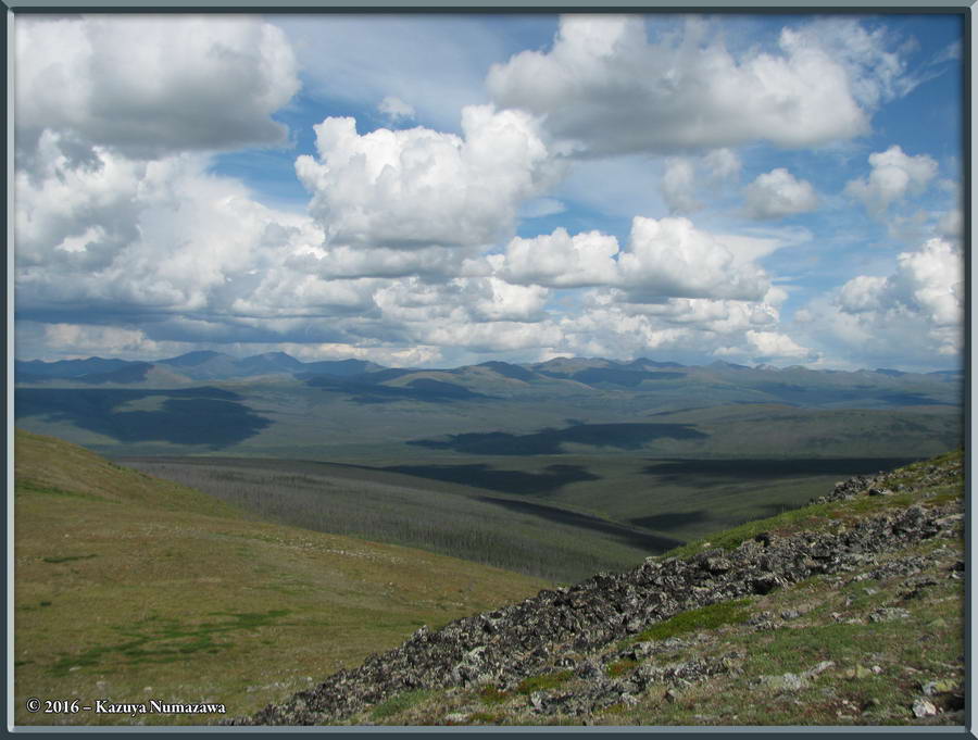
 The first shot here is another which shows Upper Table Top Mountain with our party of people all spread out. The second shot shows some distant Tors and the third shot is a scenic shot taken from the summit area.
|
 Here is a shot of this flat 3,130 foot summit with people preparing for lunch. The second shot is a scenery shot in which you can again see the evidence of the 2004 forest fire. The third shot is zoomed in to some distant Tors.
|
 Here is a zoomed-out shot of those Tors you saw in the previous row. Then there are two shots of a Hoary Marmot (Marmota caligata).
|
 Here is an amazing shot of the sky and clouds! That is followed by two shots of Chris and Zena the dog.
|
 Okay, in case it is not obvious, we are now descending. The third shot shows the entire Table Top Mountain - Lower on the left, then the Saddle or Plateau and then on the right, Upper Table Top Mountain.
|
 In first position in this row is a nice shot with an abundance of Chamerion angustifolium (Fireweed). The second shot is Chamerion latifolium (Dwarf Fireweed) and the third shot just shows a BIG SKY! And that ends the photos from this adventure. On the way home we stopped for a beer and dinner.
|
| End July 9th, Begin July 13th
|
 Okay, now it's Wednesday, July 13th and the weather forecast is for the next two days of hot and sunny weather, to be followed by a week or more of rain, so we decided to go out! (The forecast was correct too!) I recommend that you now go back to the top of this page and look at the map again. Note that the Wickersham Dome Trailhead begins at Mile 28 on the Elliott Highway. The first shot in this row shows a trail shot down pretty low on the mountain. The second shot was taken quite a bit higher in elevation. The third shot shows a mushroom growing in a patch of moss.
|
 Here is an up close and personal shot of that mushroom which is growing in the patch of moss. The second shot shows Salix reticulata and the third shot shows Dryas octopetala.
|
 The first two shots in this row show Arctostaphylos alpina - Alpine Bearberry. The third shot is an Aconitum delphiniifolium and if you put your mind into the right frame of reference this can look like either an alien or an alien egg.
|
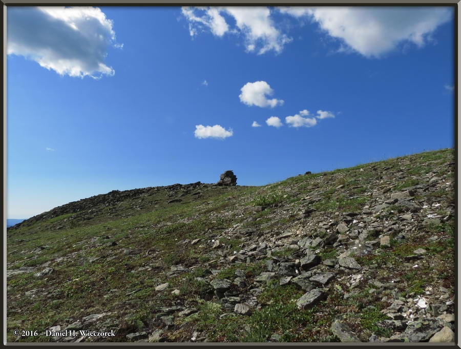
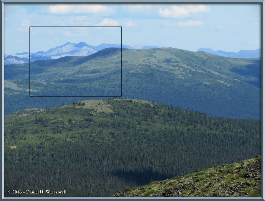
 The first shot in this row, taken as we climbed, shows some nice scenery. The outlined area shows the area of the next photo. In this zoomed-in shot which shows the outlined area of the previous photo, you can see the radio tower which is on the summit of Wickersham Dome. The third shot shows a distant mountain or mountain range.
|
 The first shot here shows the trail and Kazuya. The second shot is zoomed-in to that same mountain or mountain range as the third shot in the previous row. The third shot shows a Rubus chamaemorus - Cloudberry. This is a rather uncommon plant and each one of them only bears a single fruit. We came across quite a large patch of them, enough so that we could get a few to taste. Some sources say they are heavenly, some say tart, some say creamy like yogurt. We decided that they were nothing special.
|
 Here's a shot of me shooting a photo and then a sign which shows that we've now come 1.7 miles. The third shot is another sign - we're not going that far though!
|
 Now we have come to the first false summit and here is a Hoary Marmot (Marmota caligata) sunning itself. The first two shots in this row are greatly zoomed in - the third shot shows the rock that this critter was sunning itself on. We were that far away, but we spooked it and it took cover.
|
 Now we are continuing to climb and there is another Hoary Marmot sunning itself on a different rock - can you find it in the first shot? The second image is a two-shot panorama showing scenery. You can see the radio tower at the summit. The third shot shows the same Marmot as you saw in the first shot in this row, but a different animal than you saw in the previous row.
|
 Here are three more shot of that Marmot. The third shot shows just how close Kazuya was able to get to this animal by just going very slowly. In the center shot in this row note that this animal has a tag in its right ear.
|
 While Kazuya has been "stalking" that marmot I have slowly been continuing to climb and here are two shots of me playing on some rocks while I am waiting for Kazuya.
|
 Here are two iPhone panorama shots. In both of them you can see the radio tower at the summit.
|
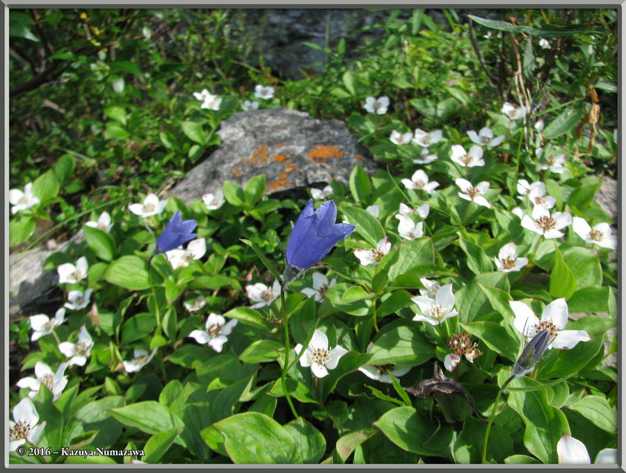
 Now we are getting pretty close to the summit and the first shot in this row is a specimen of Saxifraga tricuspidata. The second image is a High Dynamic Range image Tone-mapped from three exposure bracketed shots taken from the summit while we were eating the lunch which we took with us. The third shot shows another Campanula lasiocarpa along with some Twinflower (Linnaea borealis).
|
 In the first shot here is Cornus canadensis and a couple of Campanula lasiocarpa. Here is a zoomed-in shot which shows some place deep in the White Mountains. The third shot is a scenic shot and the outlined area shows the area of the previous photo.
|
 Here is another iPhone panorama, this one taken from the summit. The second shot shows an iPhone screen capture which indicates our Latitude, Longitude and Elevation. The radio tower here is an AT&T tower and our iPhones are served by AT&T, so we had reception here! The third shot is a scenic shot and actually there are two people near the right side of the photo - can you find them?
|
 The first shot in this row merely shows the ID mark on the AT&T Tower. On the USGS Topographic Map of this area there is a "VABM, Aggie, 3207 (ft)". This proved to us that is the spot on the map where we were! The second shot shows the entire AT&T Tower and Kazuya searching for flowers. The third shot is one of Castilleja elegans - the Elegant Indian Paintbrush. On this entire hike, right here at the summit was the only place where we found this species, and not many of them.
|
 In this final row are two more shots of Castilleja elegans - the Elegant Indian Paintbrush and a shot of Monkshood. Now please continue on to page 5 and pick up at about 2:15 PM on this adventure.
|
| End Page 4, but July 13th Continues on Page 5
|
|
Thanks so much for taking the time to look at this page. Please continue on to page 5 for the continuation of this adventure at about 2:15 PM, its conclusion, our campsite and then another adventure and more photos!
|
Go To Page:
|

Link to Amazon.com (new window).
We get 2% of whatever you spend if you go to Amazon from this link!! Please shop on Amazon from here.
|
If you would like to donate to our hiking & traveling fund or show your appreciation for our efforts you can donate through PayPal. A single donation will entitle you to request a single full-sized photo IN THE DONATION MONTH - which you may then use as a desktop wallpaper or whatever. The copyright will be retained by us and the photo will be inconspicuously marked with the copyright symbol (©), year and photographer's name. (Donation probably not tax deductible.)
|
|