posted: August 31st, 2010 |
Go To Page: |
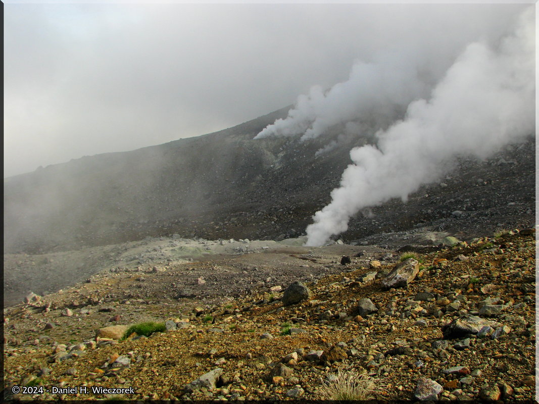
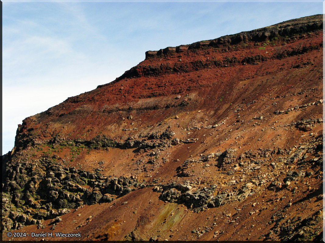
This page begins with August 10th at 5:33 AM. This is our final day of climbing on Hokkaido - The Alaska of Japan - in Daisetsuzan National Park. Today we'll climb the highest peak on Hokkaido - Mt. Asahi (Asahidake). There are 46 photos from today. At the bottom of the page there is a comprehensive list of the mountains we climbed in Daisetsuzan National Park. Click on any thumbnail to begin.
|
Begin August 10th - Vacation |
  The time is 5:33 AM. We are walking from the Youth Hostel up to the Ropeway for the first Ropeway of the day at 6:00 AM. In the 2nd photo we are on our way up the Ropeway and we look out and see these 3 deer beside the pond. The 3rd photo was at 6:28 AM. We have gotten off the Ropeway and are now hiking from there up to Sugatami Pond. The sun has already risen over the summit of Mt. Asahi (Asahidake). |
Aug10_006_RopewayTo SugatamiPond_AsahidakeRC |
August10th_018_ AsahidakeClimbDayRC |
August10th_023_ AsahidakeClimbDayRC |
  Here are 2 shots showing an abundance of Geum pentapetalum. |
Aug10_023_RopewayToSugatami Pond_Geum_pentapetalumRC |
August10th_033_ AsahidakeClimbDayRC |
  The 1st shot has been stitched together from 2 photos of the Reflection of Mt. Asahi (Asahidake) in Sugatami Pond. This image was enhanced with Shadow Illuminator Pro and the Highlights were also darkened. The 2nd photo is also stitched together from 2 separate photos. It is once again the Reflection of Mt. Asahi (Asahidake) in Sugatami Pond. This photo was also enhanced with Shadow Illuminator Pro. (Map HERE) |
Aug10_035_36_SIP_SH_Ropeway ToSugatamiPond_ReflectionRC |
Aug10_037_39_SIP_ SugatamiPond_ReflectionRC |
  The 1st photo is looking back down at Sugatami Pond and the Emergency Shelter. The 2nd photo shows some steam fumaroles on the side of Mt. Asahi (Asahidake). |
Aug10_051_Sugatami PondToStation6_SceneryRC |
Aug10_053_Sugatami PondToStation6_SceneryRC |
  The first photo in this row again shows Sugatami Pond and the Emergency Shelter - notice that the sun angle has now changed significantly, as has our elevation. The 2nd shot shows some people disappearing into the clouds in front of us. Amazing how quickly the clouds can move in. The 3rd shot shows the clouds moving on - please don't come back. |
Aug10_057_Station6 ToStation7_SceneryRC |
Aug10_066_Station7 ToStation8_SceneryRC |
Aug10_073_Station7 ToStation8_SceneryRC |
  Here is me with the scenic background of Mt. Asahi (Asahidake) in first position, followed by a shot of Kazuya and then scenery with nobody in front of it. |
August10th_094_ AsahidakeClimbDayRC |
Aug10_079_Station7To Station8_Scenery_KazuyaRC |
Aug10_085_Station8 ToStation9_SceneryRC |
  Looking further up the mountain we can now see "Safe Rock" - it's just a big square chunk of rock, kind of reminds one of a vault, which is probably why it's called "Safe Rock". The 2nd shot is a closer one of "Safe Rock". The 3rd shot shows the 2 of us at the summit of Mt. Asahi (Asahidake) (2,291 meters = 7,516 feet). This is the highest mountain on Hokkaido. We climbed the 2nd highest peak (Mt. Hokuchin or Hokuchindake) yesterday. This is our 4th straight day of high peak climbing. I once read somewhere that the 5th day of high peak climbing is kind of a magical day in that your heart stops beating as fast, you don't get winded as easily and in general, your body is suddenly in condition for it. Well, I can say that the 4th day is equally as magical - and for the same reasons. We attained the summit in about 1 hour less time than it should have taken us - certainly due to this phenomenon. My 62 (nearly 63) year old body felt pretty dang fine. I wish I could climb for 10 days straight - what would one feel like then?! |
Aug10_086_Station8To Station9_Scenery_SafeRockRC |
Aug10_090_Station9To AsahidakeSummit_SafeRockRC |
Aug10_096D_SIP_118K_ At_AsahidakeSummitRC |
  Now we are descending the backside of Mt. Asahi (Asahidake) headed for Mt. Kuma (Kumagadake). That is the peak you see in this photo just to the left of center. The 2nd image is 2 photos stitched together and Tonemapped. In it you can see Mt. Kuro (Kurodake) - the first mountain we climbed back on August 7th. In the 3rd photo we are looking back towards the summit of Mt. Asahi (Asahidake). The map is HERE and also at the bottom of this page. |
Aug10_113_AsahidakeDescent TowardsKumagadake_SceneryRC |
Aug10_105_106_TM_SIP_ At_AsahidakeSummitSceneryRC |
August10th_151_ AsahidakeClimbDayRC |
  Here is another shot of Mt. Kuma (Kumagadake) in first position. In 2nd position we are looking back at the summit of Mt. Asahi (Asahidake) and you can see people up there. The 3rd photo is looking ahead - beautiful blue sky. |
August10th_154_ AsahidakeClimbDayRC |
Aug10_140_AsahidakeToKumagadake_AsahidakeSummitRC |
Aug10_141_Asahidake ToKumagadake_SceneryRC |
  That's me! Mt. Kuma (Kumagadake) is behind me. The next photo shows Kazuya with red volcanic rock around him. The 3rd shot is looking down into a valley which has a lot of snow remaining in it. We did not have to go down there. |
August10th_178_ AsahidakeClimbDayRC |
Aug10_156_Near Kumagadake_Scenery_KazuyaRC |
August10th_202_ AsahidakeClimbDayRC |
  This first shot is looking down into "Poison Hot Spring Valley" from the south ridge. The 2nd shot is a Willow - probably a subspecies of Salix nakamurana. The 3rd shot is the east side of "Poison Hot Spring Valley" along with Mt. Hokkai (Hokkaidake) and Mt. Hakuun (Hakuundake) - both of which we climbed on August 8th. |
August10th_243_44_45_ AsahidakeClimbDayRC |
August10th_212_ AsahidakeClimbDayRC |
August10th_269_270_ TM_Annt_AsahidakeClimbDayRC |
  Here is "Poison Hot Spring Valley" once again, and the rectangle again delineates the area shown in the next photo. In this 2nd photo - the area shown in the previous photo - you can see that it appears that the vegetation has been blackened. Was it due to an eruption of extremely hot water or was it due to the poisonous nature of the sulfur gases? The 3rd photo shows the signpost which marks the summit of Mt. Mamiya (Mamiyadake) ( 2,185 meters = 7,169 feet). (Map HERE) |
Aug10_196a_AraiDake ToMamiyaDake_SceneryRC |
Aug10_192_AraiDake ToMamiyaDake_SceneryRC |
Aug10_199_At_ MamiyaDake_SummitRC |
  Now we are once again headed for Nakadake Onsen (Hot Spring). The first photo here shows a beautiful Campanula sp. The 2nd shot shows Nakadake Onsen (Hot Spring) - on the right side of the photo. The 3rd photo shows 2 French Brothers soaking their feet in Nakadake Onsen (Hot Spring). As you can see, there were several people here today - we could not get naked and soak. We did take off our shoes and soak our feet though. |
Aug10_212_MamiyaDake ToNakadakeOnsen_CampanulaRC |
Aug10_220_MamiyaDake ToNakadakeOnsen_OnsenRC |
Aug10_224_ NakadakeOnsenRC |
  Here is that area of Caltha fistulosa again. Yes, now we are on the same trail we hiked yesterday. And, here is the Primula cuneifolia again. The 3rd shot shows 2 smaller peaks. They are known as Big-Tsuka & Little-Tsuka Peaks. |
August10th_331_ AsahidakeClimbDayRC |
Aug10_255_NakadakeOnsen ToFlowerField_PrimulaRC |
Aug10_259_NakadakeOnsenTo FlowerField_Big_LittleThingsRC |
  Here are 2 shots of Phyllodoce caerulea - not sure if this is the same spot where we stopped yesterday, regardless, today there were thousands (at least hundreds) of butterflies swarming around here for the pollen of this flower. In the first photo I can count at least 5 butterflies. The 2nd photo shows a larger area. The 3rd photo is Gentiana triflora f. montana. This is most likely the same area we stopped at for this flower yesterday. |
August10th_361_ AsahidakeClimbDayRC |
Aug10_275_FlowerField_ Phyllodoce_caeruleaRC |
August10th_384_ AsahidakeClimbDayRC |
  The first photo in this row is one more Gentiana triflora f. montana. The 2nd photo is the reflection of Mt. Asahi (Asahidake) on one of the ponds - but not Sugatami Pond. We did not go back there again today. |
Aug10_285_ Asahidake_BlueGentianaRC |
August10th_390_ AsahidakeClimbDayRC |
  Yesterday on the way down the Ropeway we noticed this dead conifer tree which had a beautiful silver color, so today we were ready for it. Here it is. I cropped it and enhanced it with Shadow Illuminator Pro. The 2nd photo - we are back home at the Youth Hostel. The time is 4:30 PM. We started hiking 11 hours ago. |
Aug10_303CropSIP_Asahidake _RopewayDescent_SilverTreeRC |
Aug10_305D_403K_ HomeAtTheYouthHostelRC |
End August 10th Photos, Begin List of Mountains Climbed |
  Here you can find a list of all the mountains which we climbed on Hokkaido during our August Vacation. Note that a (#2) indicates that it was the 2nd time we climbed that particular mountain. |
Mountains Climbed on Hokkaido from August 7 - 10, 2010 | ||||||
---|---|---|---|---|---|---|
No. | Date | Mountain Name | Elev., Ft. | Elev., M. | ||
1 | Aug-07-2010 | Mt. Kuro (Kurodake) | 6,509 | 1,984 | ||
2 | Aug-08-2010 | Mt. Hokkai (Hokkaidake) | 7,051 | 2,149 | ||
3 | Aug-08-2010 | Mt. Hakuun (Hakuundake) | 7,315 | 2,230 | ||
4 | Aug-08-2010 | Mt. Hokkai (Hokkaidake) (#2) | 7,051 | 2,149 | ||
5 | Aug-09-2010 | Mt. Hokuchin (Hokuchindake) | 7,362 | 2,244 | ||
6 | Aug-09-2010 | Mt. Naka (Nakadake) | 6,932 | 2,113 | ||
7 | Aug-10-2010 | Mt. Asahi (Asahidake) (#2) | 7,516 | 2,291 | ||
8 | Aug-10-2010 | Mt. Arai (Araidake) | 7,162 | 2,183 | ||
9 | Aug-10-2010 | Mt. Mamiya (Mamiyadake) (#2) | 7,169 | 2,185 |
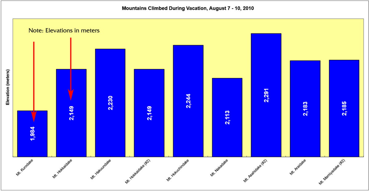
Mountains Climbed On Hokkaido from August 7 - 10, 2010 Click to see full size image (in new window) |
End List of Mountains Climbed, Here is the Map of Daisetsuzan National Park |
Wanderings in Disetsuzan National Park August 7 - 10, 2010 Click to see full size image (in new window) |
End Page 3 |
If you would like to donate to our hiking & traveling fund or show your appreciation for our efforts you can donate through PayPal. A single donation will entitle you to request a single full-sized photo IN THE DONATION MONTH - which you may then use as a desktop wallpaper or whatever. The copyright will be retained by us and the photo will be inconspicuously marked with the copyright symbol (©), year and photographer's name. (Donation probably not tax deductible.) |