 |
This is Page 1 of 1 - the best of August 2014!
posted: August 31st, 2014 |
This page actually begins with July 29th and an overnight camp-out at Mt. Takao. Then we jump to August 12th and a trip to Mt. Chokai. That's all there is for the entire month so there is only this one page. Click on any thumbnail to begin.
|
 On Tuesday July29th I had no work, but Kazuya did, I had everything accomplished that I wanted to get done, so I decided to go out and climb Mt. Takao - for the 105th time - and spend the night in the one-man tent. While climbing up to the summit of Mt. Takao I found that the Conandron ramondioides - (Iwa-Tabako in Japanese) was at the peak of its blooming, so the 3 photos in this row are all of that flower. This is a plant of very dark and damp places, generally on the rocky slopes at or very near to waterfalls. In this case it is very near to a waterfall. It's so difficult to get good photos under those conditions so I had to use the flash. These shots came out quite well.
|
 When I got to the summit of Mt. Takao it was very hazy, so one could not see any great views. After confirming that, I continued on to I-Ccho-Daira, where I was planning to stay. As I was nearing I-Ccho-Daira I saw, beside the trail and ahead of me, some Mountain Lilies. The first shot in this row shows a section of the steep trail and the Mountain Lilies off to the right side. The second shot was taken as I walked closer to the Lilies and of course the 3rd shot is a close-up of one of the flowers. For the most part these flowers were already finished for the season. This was the only plant I saw which still had good flowers.
|
 The first shot in this row shows a Giboushi (Japanese common name) flower. It was in bloom right beside the Mountain Lilies - you can find it in the row above in the center photo. The 2nd and 3rd shots in this row are similar enough so that I probably should have only included one of them, but the 3rd shot shows more of those interesting clouds, which was the purpose of both of these photos.
|
 The first image in this row is an HDR image created from 3 exposure-bracketed shots in Photomatix Pro using the Details Enhancer Option. The 2nd shot was actually shot on July 30th, not the 29th. I found this single Purple Chinese Bellflower as I was descending via the Hikage Creek Road the following morning. The sun was at a poor angle for capturing it, but it was the only one, so I had to try. Notice that the top is broken off - damn flower thieves!
|
| End July 29th, Begin August 12th
|
 For you who are looking at the site with a mobile device and the "mouseover" image on the index page does not work - here are the 2 images which are used. The first image is the default one and the second image is what a person with a desktop/laptop computer sees when he/she hovers over the image.
|
 We both had the week of August 10th off from work, but unfortunately a typhoon was passing through and then a stationary occluded front remained after it and we had mostly rain. We tried to climb Mt. Chokai on August 12th and 13th, but we were not successful. This would have been our 4th climb of Mt. Chokai. You can find the photos from our 2005 CLIMB HERE (new window or tab), from our 2008 CLIMB HERE (new window or tab) and from our 2011 CLIMB HERE (new window or tab). Of course our photo book about climbing Mt. Chokai was Volume 2 in the "Climbing a Few of Japan's 100 Famous Mountains" series of books and you can find the details page for that book HERE (new window or tab). All 3 photos in this row show this amazing cloud which was covering the top of Mt. Chokai as we were beginning our climb. Immediately upon seeing it I referred to it as "The Hall of the Mountain King" because it just had that kind of eerie feeling to it. One just knew that some powerful forces were at work up there to create such a cloud. The outlined area in the center photo shows the approximate area included in the 3rd photo. By the way - I posted this photo on a forum and received the answer that this is a combination of lenticular and cumulus formations.
|
 Here are 3 more shots of "The Hall of the Mountain King" - all very similar, but slightly differently cropped and/or toned. This ia a combination of lenticular and cumulus formations high on the mountain - with a strong wind.
|
 Very close to the starting point for climbing Mt. Chokai there is an overlook which looks down into a very deep valley. The first shot in this row shows a portion of that valley. Note the place where there is a triple waterfall and also notice the one large waterfall - we'll show you more photos of those waterfalls soon. The 2nd shot was taken looking back down to the starting point at Hokodate.
|
 The first photo in this row again shows that triple waterfall and the one large waterfall. The outlined area in this photo shows the approximate area which is included in the 2nd photo in this row. The 3rd shot is zoomed in to the large waterfall.
|
 These 2 photos were taken while zooming into a side valley of this very deep valley. Again, the outlined area in the first photo shows the approximate area which is included in the 2nd photo.
|
 A bit later we looked up and saw these weird clouds. Thanks to the fact that I posted these photos on a forum and asked what kind of clouds they are I got this answer - Undulatus asperatus - and here is a link to the WIKIPEDIA page (new window or tab) that talks about them.
|
 The weather is still kind of decent - just cloudy, but nice temperature. In the first photo in this row one can see down to the west and out into the Sea of Japan. In the 2nd photo Kazuya stands beside a small snowfield. In the 3rd photo we have arrived at the mid-slope, or lower, Hut and we are looking out at Chokai Lake. This year was the latest in the day we had ever started climbing the mountain, so we had reservations to stay at the hut here, it was our first time to stay at this lower hut. We were glad we chose to do so as the weather turned to crap just before we arrived and rained steady for the rest of the day.
|
 Here are 3 shots of Chokai Lake which were taken at various times during the late afternoon when the clouds parted enough to be able to see for a moment or two. We noticed that something was different about the lake - we could never remember seeing an island before, so I got out my iPhone and used my Kindle e-book reading app to look at the "Climbing a Few of Japan's 100 Famous Mountains - Volume 2: Mt. Chokai" book (Amazon.com link [HERE]) which I had on it and we saw why it looked different. We'll show you some photos from other years later and you too can see what's different. And, that's all of the photos from August 12.
|
| End August 12th, Begin August 13th
|
 Now it's August 13 and we are continuing to climb on towards the summit (2,236 m = 7,336 ft). The forecast is for clearing later on, although it is now raining lightly. My camera is packed away in my backpack wrapped in plastic bags, but Kazuya's camera is small enough so that he can carry it in his rain jacket pocket. Here are 2 flower shots and a shot of a small shrine. There were not as many flowers in bloom this year as we usually see here - was it because this was a hot summer or what?
|
 The weather is not improving as we climb, in fact it's getting worse and we are debating about whether to continue or to turn around and go home. One minute we think we should continue and the next minute we think we should call it quits - it's not the first time we've been here - so this is not a "do or die" situation as far as getting to the summit. By the time the 3rd photo in this row was taken we were already heading back down the mountain - the decision made! And - wouldn't you know it - it looks like it might get sunny now!
|
 As we passed by Chokai Lake on our descent it looked like this (first photo in this row), but 1 minute later the sky looked like the 2nd photo of people taking a break at the Lower Hut. So, we continued down and headed to Kazuya's hometown in Funagata, Yamagata Prefecture. As one crosses Yamagata Prefecture from west to east on the train from Sakata one has wonderful views of Mt. Chokai along the way and we could see that we had made the right decision - to call it quits. The weather did NOT improve and in fact it got worse. We could barely even see the base of the mountain from the train, and certainly not the summit. We did NOT kick ourselves and say "Oh, we should have continued".
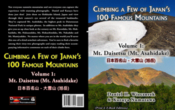
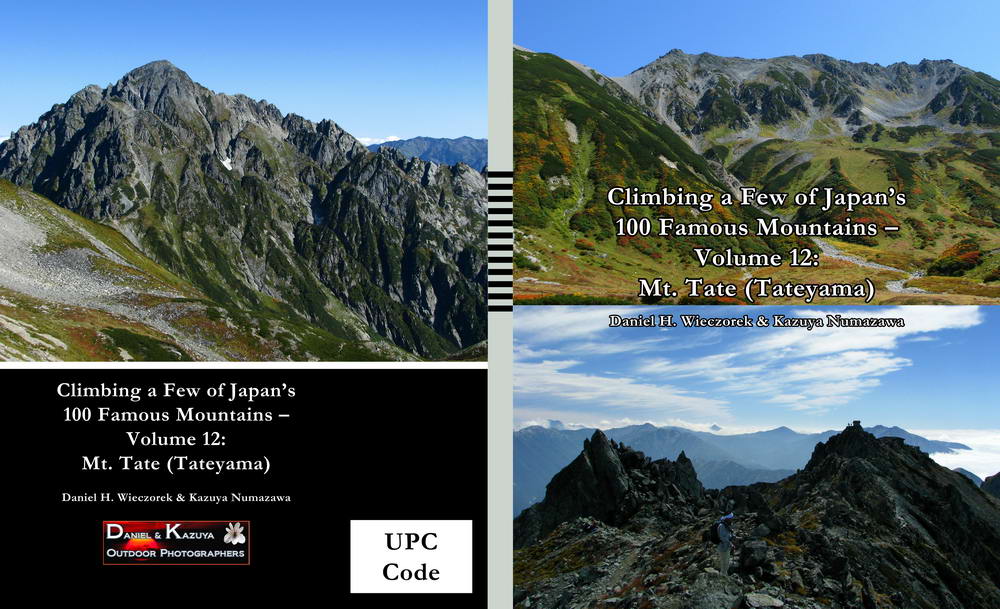
The 3rd image is the cover of our latest in the "Climbing a Few of Japan's 100 Mountains" series of books. This newest one is - Climbing a Few of Japan's 100 Famous Mountains - Volume 12: Mt. Tate (Tateyama), which was approved for sale on August 26, 2014. You can find a Details page and a sample PDF file for this book HERE (new window or tab). With 176 pages and about 196 photos it is just two pages shorter than Volume 11!
|
| End August 13th, End August 2014's Photos, Begin Year Comparisons - Chokai Lake Level
|
 As promised up in Row 12, here are some comparison photos from 2005, 2008, 2011 and this year - 2014 - of Chokai Lake. The 2 photos in this row show 2005 and 2008 - not the shoreline on the right side of the lake.
|
 These 2 photos show Chokai Lake in 2011 and 2014. In the 2014 photo you'll notice why the lake looked different to us this year - it's the first time the water level has ever been high enough so that the lake has an island! WOW!
|
| End Year Comparisons - Chokai Lake Level, Begin Miscellaneous Links
|
 Here are links to separate web pages - all of them will open in a new window (or new tab). The first link shows some photos of our DVD Collection, an AVI Movie of our Home Theater System and 9 photos of our Sharp Aquos TV. The 2nd link shows our entire DVD collection in DVD Profiler (if you're asking yourself what might be good to rent for the weekend). The DVD's will be sorted by date purchased. You can click on the "Title" Column to sort that way if you desire. The 3rd link shows our entire DVD collection in php DVD Profiler, which is much more sophisticated than the plain vanilla DVD Profiler just above it. The 4th link takes you to a set of pages which show you the FRONT cover-art of our entire DVD collection.
|

January 1, 2013 - DVD Collection & Home Theater System


|
|
HERE IS

Please check it out by clicking on the above button.
(Click on the "Studies of Plants and Wildlife" link in the new window.)
|
|
Here is a small hint to let you know that we'd be thrilled to have you buy one of our books. For additional information regarding any title please click the "General Information" tab on the "Our Books" button down at the bottom of this page. Click on any thumbnail to go to its Amazon.com webpage.
|
An animated gif of some
of our publications
(Does Not Include 100 Mountains Series)
(34 seconds)

For details please click the "Our Books"
Button at the bottom of the page. |
An animated gif of our
Climbing a Few of Japan's
100 Famous Mountains Series
(Paperback Editions)
(28 seconds)
For details please click the "Our Books"
Button at the bottom of the page. |
An animated gif of our
Climbing a Few of Japan's
100 Famous Mountains Series
(Hardcover Editions)
(26 seconds)

For details please click the "Our Books"
Button at the bottom of the page. |
| End Miscellaneous Links, End Page 1 of 1, August 2014
|
|
Thanks so much for taking the time to look at the website this month. We hope that you found something which you enjoyed. You can use the e-mail link below to respond with any feedback you might have.
|

(will open in new window)
|

Link to Amazon.com (new window).
We get 2% of whatever you spend if you go to Amazon from this link!! Please shop on Amazon from here.
|
If you would like to donate to our hiking & traveling fund or show your appreciation for our efforts you can donate through PayPal. A single donation will entitle you to request a single full-sized photo IN THE DONATION MONTH - which you may then use as a desktop wallpaper or whatever. The copyright will be retained by us and the photo will be inconspicuously marked with the copyright symbol (©), year and photographer's name. (Donation probably not tax deductible.)
|
|


